Ernie Liberatore
Final project topic is World War II Operation Husky. The June 10th, 1943 Invasion of Sicily.
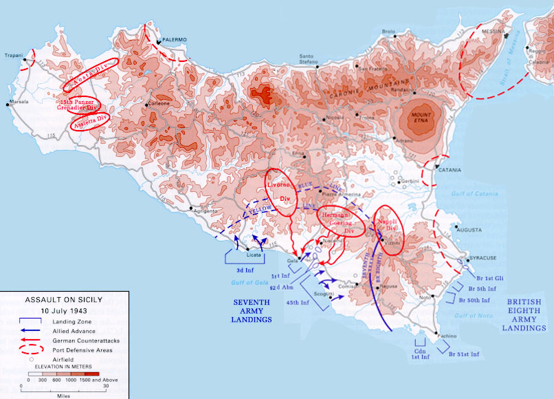
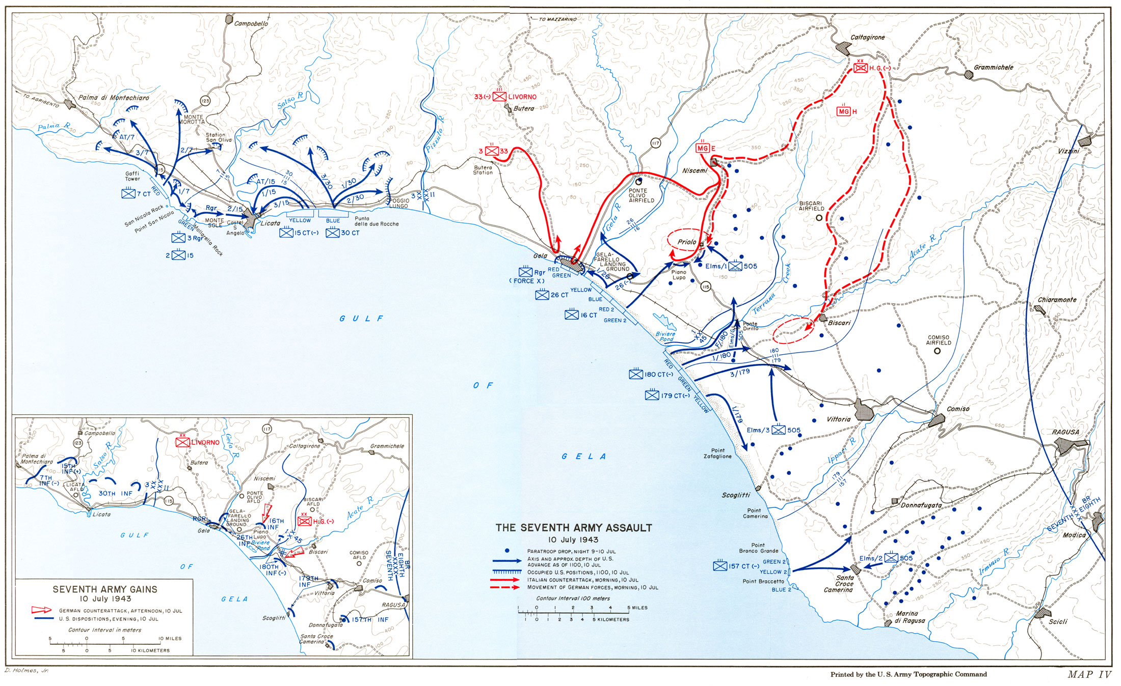
The map subject will be on the Allied Beach Landings of Sicily. More Specifically the US 7th Army beach landings under General George S Patton in and around the coastal village of Gela Sicily.
Map Type, Topographic map.
The map will show village of Gela, roads, troop positions, enemy fortifications, possibly mapping the terrain. US Ship positions, beach landing boast and their landing sites, including paratrooper drop zones in the early morning of June 10th 1943.
The data will be from from Military Operation Planning from the 1940's.
Mapping steps to start with a map outline of the gulf coast of Gela Sicily, possibliy terrain mapping followed by mapping villages, and roads in and around Gela. Troop posistions, and land fortifications.
Challenges I see will be finding a detailed village map of Gela along with exact Beach fortifications placed around Gela.


